Protected Bike Lanes
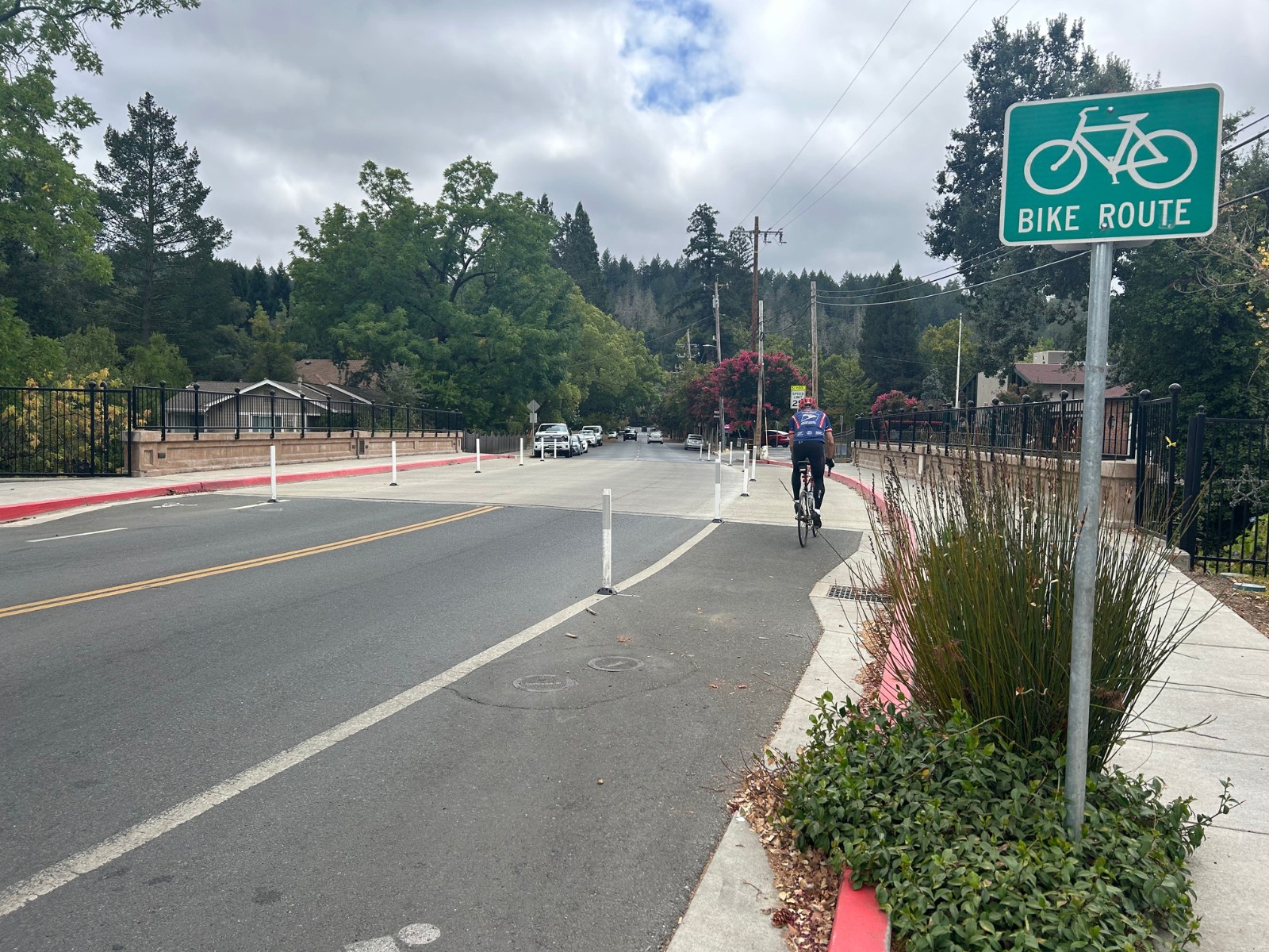
Protected (also called “separated”) bike lanes are bike lanes that are separated from moving vehicle traffic by a painted buffer and a vertical separation element, like curbs, bollards, or parked cars.
- Berry Street in Calistoga
- Imola Street (Butler Bridge) in Napa City
Parking Protected Bike Lanes
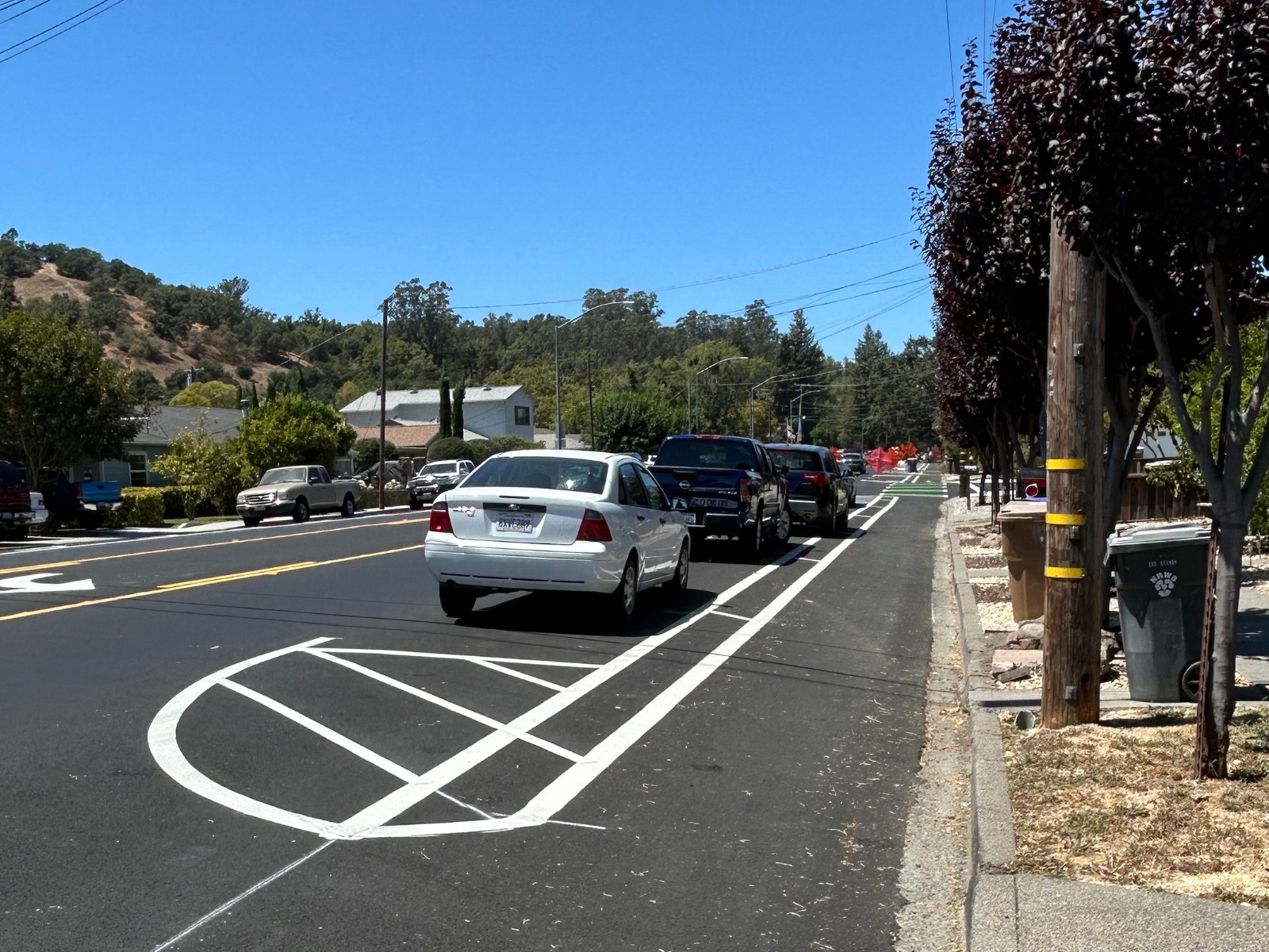
Parking protected bike lanes are a type of protected bike lanes that are separated from moving vehicle traffic by the parking lane.
- Browns Valley Road/1st Street in Napa City
- “Separating Protected Bike Lanes” – NACTO
- Browns Valley/First Street Project Page – City of Napa
- Browns Valley Road FAQ – Napa County Bicycle Coalition
Buffered Bike Lanes
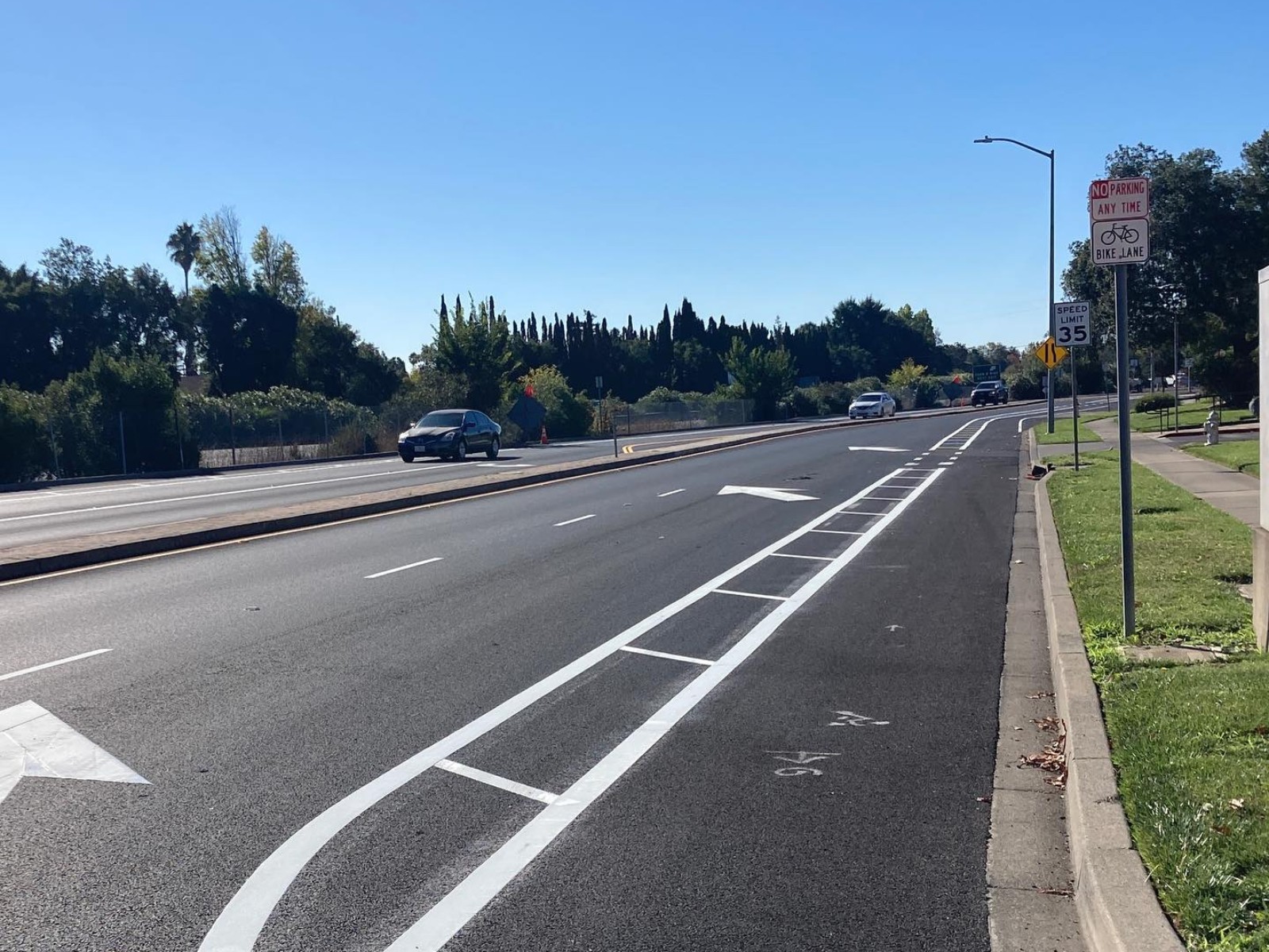
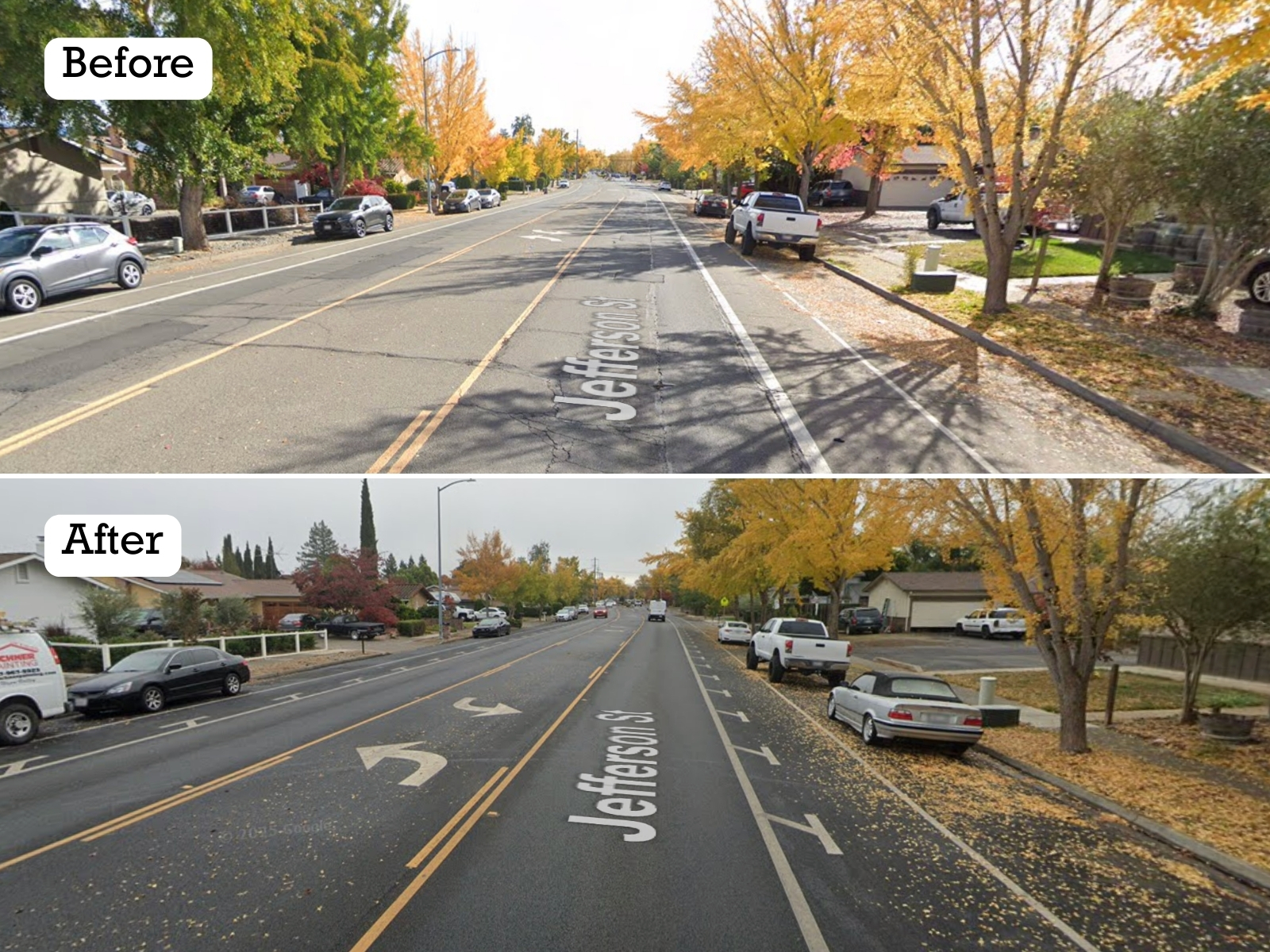
Buffered bike lanes are bike lanes with a painted “buffer zone” that provides more space between the moving vehicle traffic and bike lane.
- City of Napa: Browns Valley Road/1st Street; Jefferson Street (Sierra to Trower); Freeway Drive (1st to Kilburn); Coming soon to Lincoln Ave
- “Buffered Bike Lanes” – City of Fremont
Bulb Outs/Curb Extensions
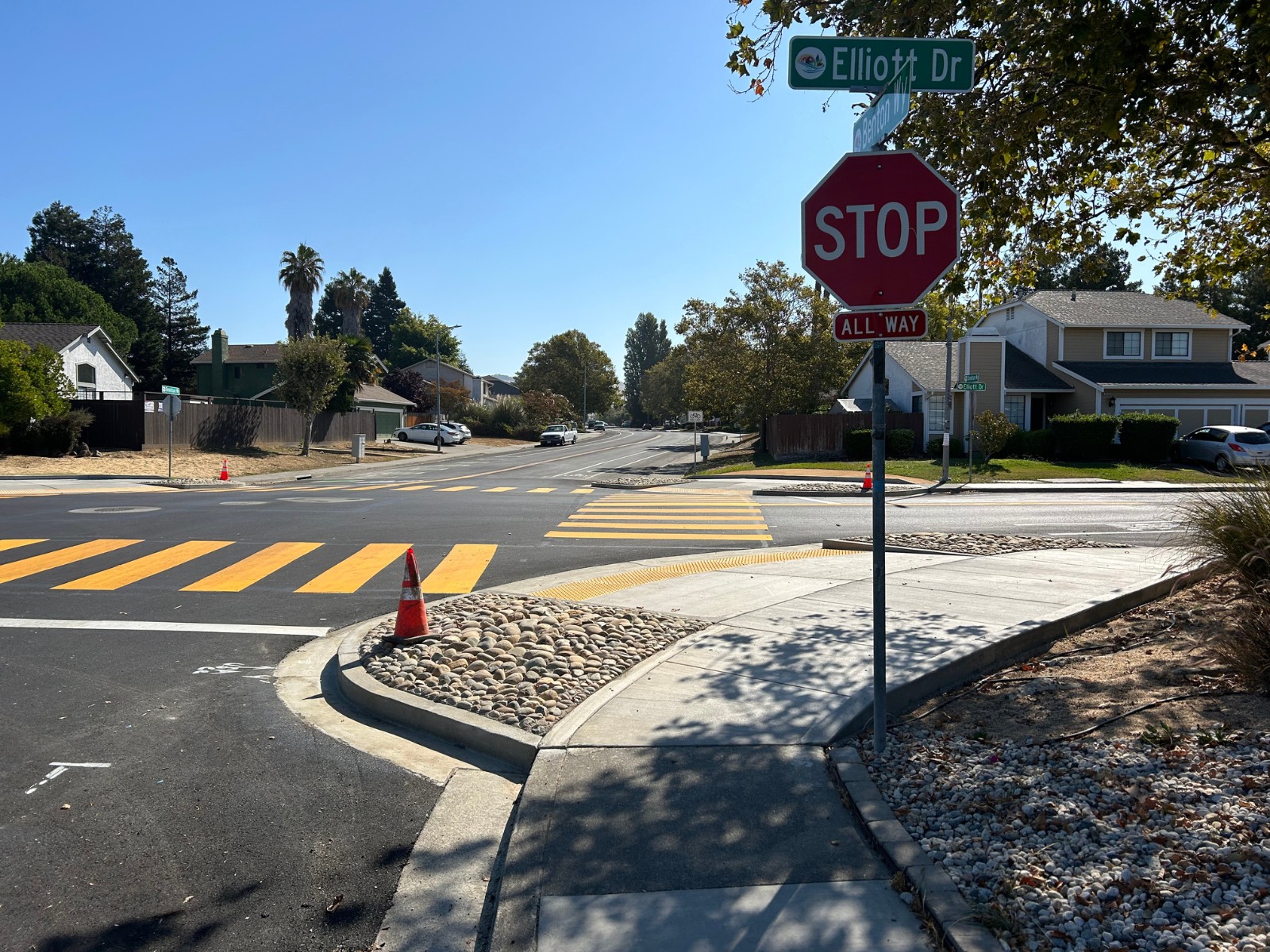
Bulb outs, also known as curb extensions, are extensions of the sidewalk curb into the roadway at crosswalks (midblock and intersections), which narrow the crossing distance, slow vehicles through the space, and improve pedestrian visibility.
- American Canyon: Benton Way and Elliot Dr, Chaucer Ln, Huntington Way, and Hummingbird Way; Donaldson Way West and James Rd
- Napa City: Salvador Ave and Byway East; Coming soon to Coombs St (5th to Imola) and Laurel St (Griggs to Freeway)
- St. Helena: Madrona Ave and Kearney St; coming soon to Pope St and Edwards St; Main St and Spring St
- “Curb Extensions” – NACTO
- “Bulbout/Corner Extension” – City of Napa
Rectangular Rapid Flashing Beacons (RRFBs)
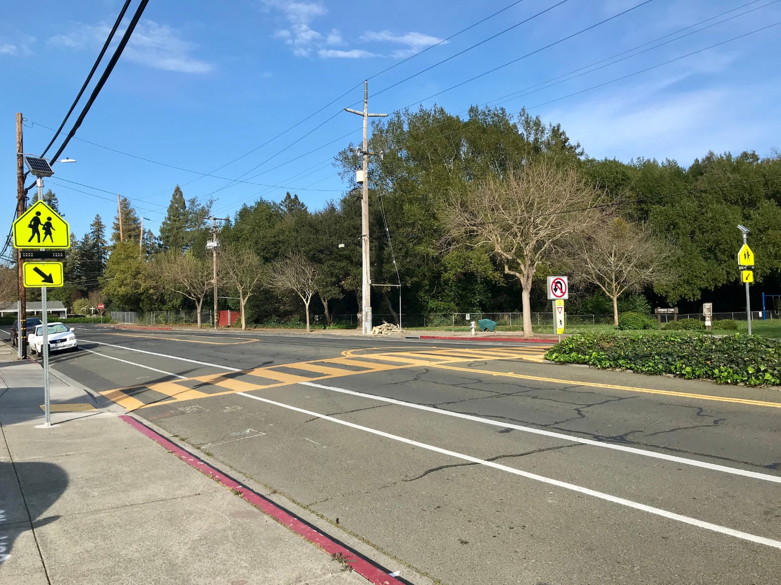
RRFBs combine a pedestrian crossing sign with bright flashing beacons that are activated by a button pressed by a bicyclist or pedestrian.
- American Canyon: Elliot Dr between Knightsbridge and Folland; Silver Oak Trail & Toscana Dr; Eucalyptus Dr between Wetlands Edge and Greenwing
- City of Napa: Vine Trail & California Blvd; Third St & Seminary St; Pueblo Ave & Crocker St
- St. Helena: Pope St & College Ave; Highway 29 & Charter Oak Ave; Tainter St between Oak and Kearney
- Calistoga: Coming soon to Brannan St & Lincoln Ave
- “Rectangular Rapid Flashing Beacons (RRFB)” – Federal Highway Administration
- “Flashing Beacons” – City of Napa
Bike Boxes
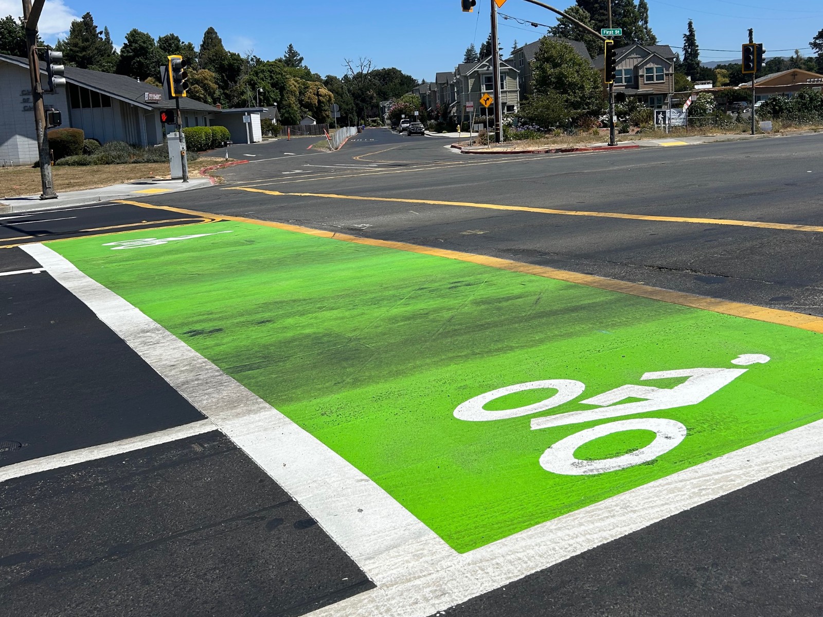
Bike boxes are designated areas at the front of traffic lanes that provide people on bikes with safe and visible ways to get ahead of queuing traffic and to position themselves for a left turn (NACTO).
- City of Napa: First Street and Freeway Drive; coming soon to S Coombs St and W Imola Ave
Narrowing Vehicle Lanes
It is easy for motorists to speed when vehicle travel lanes are overly wide – in many cases, vehicle travel lanes that are 12 feet wide or wider (highway standard) in residential or downtown areas can be narrowed to something more context appropriate, like 10-11 feet. Narrowing the travel lanes provides a visual cue to drivers to slow down, and can make room for other safety improvements.
- American Canyon: Donaldson Way from Benton Way to Amarillo Dr
- City of Napa: Jefferson St (Sierra to Trower); Freeway Dr (First St to Kilburn Ave); First St/Browns Valley Rd (Freeway Dr to McCormick)
- St. Helena – Spring St (Valley View St to Sylvaner Ave)
- “Lane Width” – NACTO
- “Narrow Lanes Save Lives” – Johns Hopkins University
Green Conflict Markings
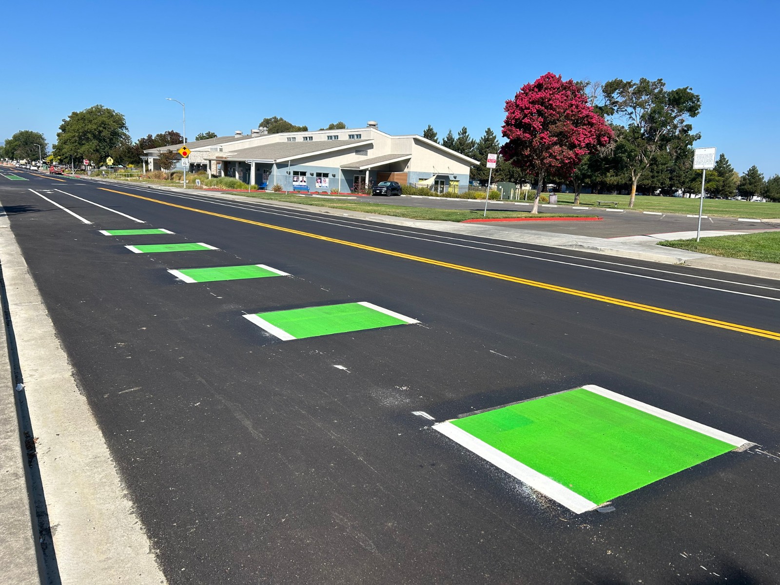
Green conflict markings are bright green dashed paint marks applied in bike lanes in places where drivers may cross the bike lane, like at intersections and driveways. These are used to increase driver and bicyclist awareness of potential conflict zones.
- American Canyon: Benton Way; Donaldson Way West, Shenandoah Dr; Silver Oak Trail
- City of Napa: Jefferson St (Sierra to Trower); Freeway Dr (First St to Kilburn Ave); First St/Browns Valley Rd (Freeway Dr to McCormick); Salvador Ave (SR 29 to city limits)
- St. Helena – Coming soon to South Crane Ave
- County of Napa – Silverado Trail
- “Conflict Zone Markings” – Global Designing Cities Initiative
- “Green Bike Lanes FAQs” – Town of Los Gatos
Buffers With Rumble Strips
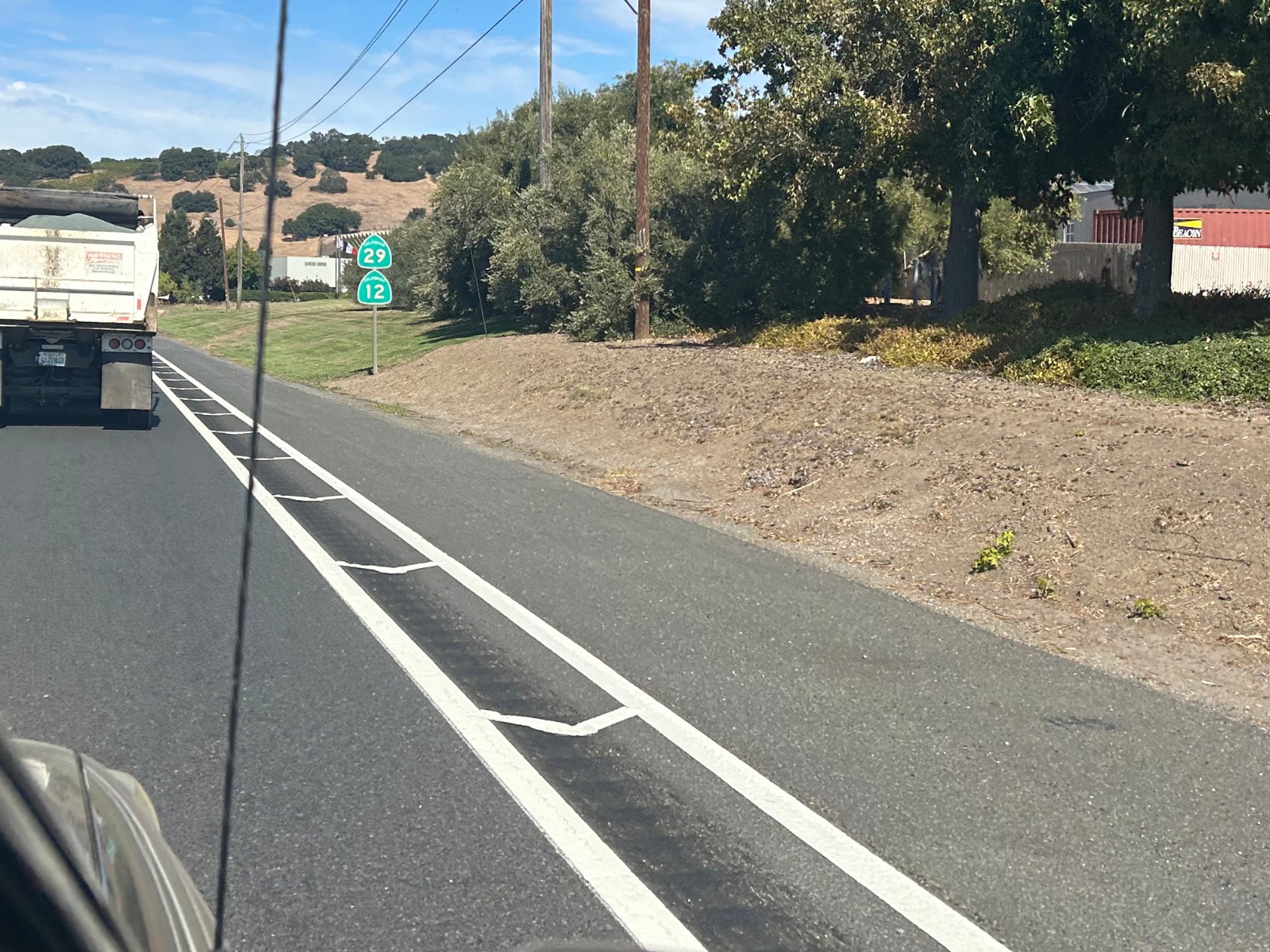
Including rumble strip segments in bike lane buffers (see “Buffered Bike Lanes” above) provides another layer of separation between bicyclists and higher speed traffic, as drivers that begin to move into the bicycle lane will feel and hear the rumble strips before entering the bike lane.
- Caltrans – Highway 29 south of Calistoga; Highway 12/29 between Soscol Ferry Road and American Canyon
- County of Napa – Coming soon to Silverado Trail
- “Bicycle Best Practices” – Caltrans (page 9 of PDF, C-1 of document)
- “Rumble Strips And Bicycle Accommodation” – Federal Highway Administration
Speed Cushions
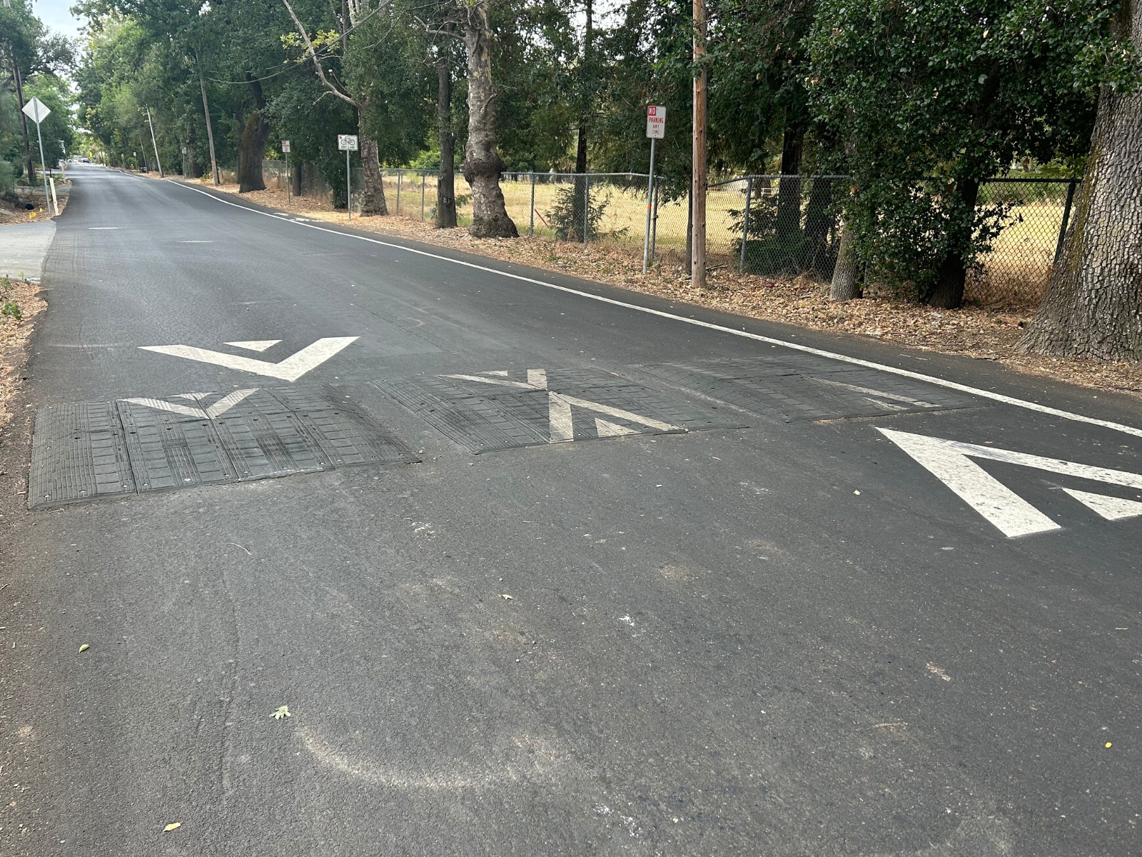
Speed cushions are similar to speed bumps/speed tables with wheel cutouts in between the raised sections that allow wider set vehicles like emergency response vehicles, to drive through them unaffected. Speed cushions also have flat tops for regular vehicles to comfortably drive over them at 20-25 mph.
- American Canyon – Wetlands Edge Road
- Napa City – Salvador Ave West
- St. Helena – Coming soon to Pratt Ave, South Crane Ave, Spring St, Spring Mountain Rd
- Calistoga – Grant St between Maggie Ave and Garnett Creek Ct
- “Speed Cushions” – NACTO
- “Toolbox of Individual Traffic Calming Measures Part 2: 3.11 Speed Cushion” – Federal Highway Administration
Raised Crosswalks
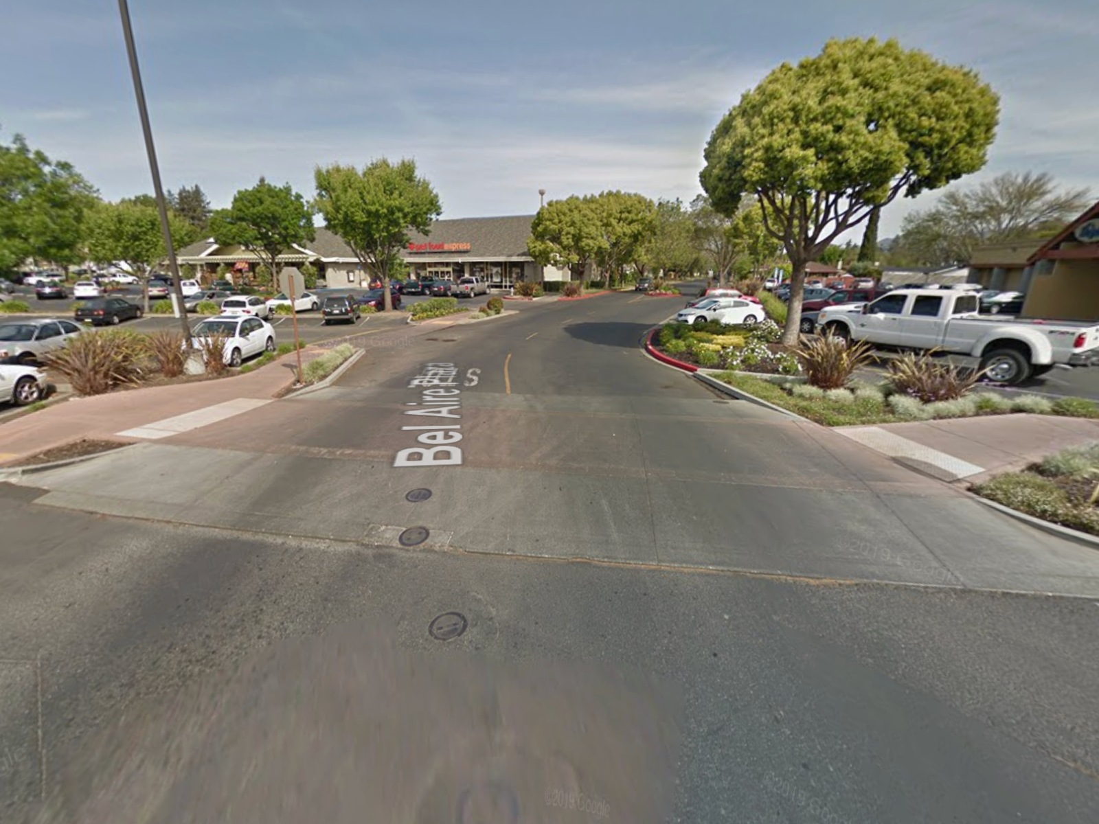
Raised crosswalks are crosswalks that are elevated to be up to the level of the sidewalk. This forces drivers to slow down at the crossing, and raises the pedestrian so that they are more visible to drivers.
- American Canyon – Watson Ranch development
- Napa City – Bel Aire Plaza near Diablo St entrance
- “Raised Crosswalks” – SF Better Streets
- “Raised Crosswalk” – Federal Highway Administration
Leading Pedestrian Intervals (LPIs)
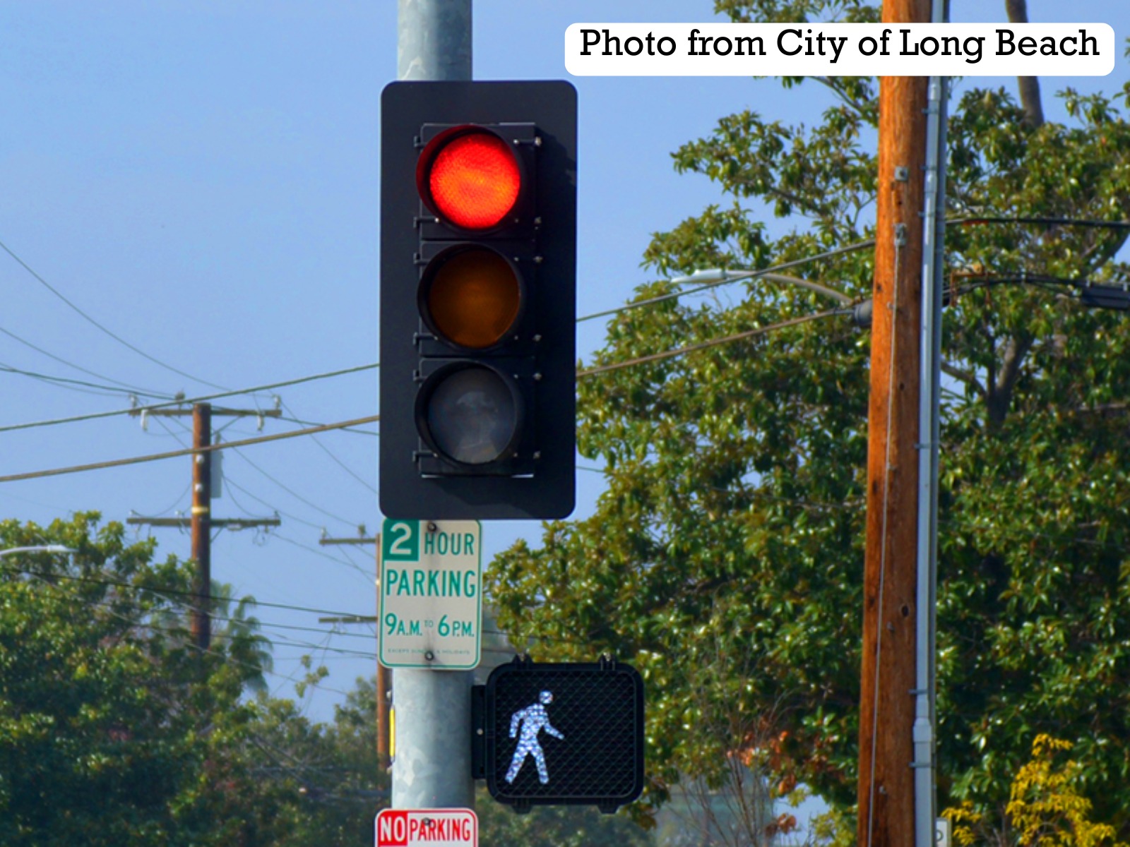
Leading Pedestrian Intervals (LPIs) are a traffic signal setting that gives pedestrians the “cross” signal a few seconds before parallel traffic is given the green light. This allows pedestrians a few seconds to get a head start in the crosswalk, improving visibility and reducing risk of right or left turn collisions.
- Napa City – Soscol at First; Redwood and Solano
- St. Helena – Main and Madrona; Main and Adams
- “Phasing Examples” – NACTO
- “Leading Pedestrian Interval” – Federal Highway Administration

